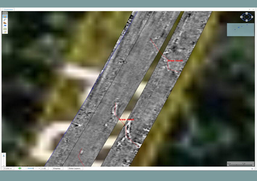
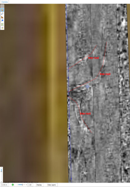
Tree Root Mapping
The Challenge
Tree roots pose a challenge, as new infrastructure is built, it is important the trees surrounding are not damaged in the process. Additionally, councils require retainer fees per tree in case trees die and require removal and new trees elsewhere. Mapping tree roots in the past has been a heavily time-consuming process often lacking results.
Our Solution
To provide detailed tree root mapping we deployed the Kontur GroundTM 3D GPR. This approach provided a high-quality 3D dataset that allows for tree root mapping and on top of this verifying the results via non-destructive digging (NDD) methods. The unit was vehicle-towed at 22 km per hour and achieved 4 metre depth penetration, enabling for a high-quality data set that was captured rapidly.
Outcomes
From the NDD results, there were eight potholes and the 3D GPR method successfully mapped tree roots in each one. Tree roots mapped were as small as 20mm. From these results the EPA in Victoria is considering changing the methodology around tree root investigations.
Taking into consideration these findings will help our client decide on the best approach to manage the road surface into the future.