Subsurface Utility Investigation
The Challenge
In challenging areas, traditional subsurface utility investigations methods via EMI/ 2D GPR, cannot always resolved the services seen on utility provider plans. In addition, old or miscellaneous services that are not represented on any plans are often missed as the AS5488 method cannot ensure all services represented on plans or not, can be captured.
Our Solution
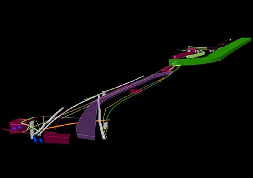
Deploy the innovative 3D Ground Penetrating Radar (GPR). This approach provides a 3-dimensional analysis of the subsurface, illuminating subsurface utilities both metallic and non-metallic.
Deploying innovative 3D Ground Penetrating Radar
The 3D GPR is towed behind a vehicle allowing for fast and complete data capture over a given area. Wherever a vehicle can drive safely, the 3D GPR will follow in tow. This alleviates safety concerns when performing the survey on the road and can eliminate all traffic control costs.
On this specific job, the unit was towed at approx. 20-30km/h and achieved a depth penetration of over 4m. This unit can travel at a faster speed up to 80-100km/h but depth penetration may only be around 1m.
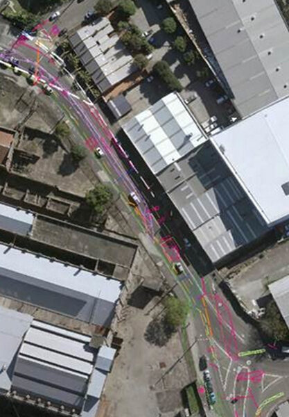
Subsurface Utilities Survey
A subsurface utility investigation was performed prior and successfully located most utilities however struggled on overlapping and deeper services. The 3D GPR was able to resolve the missing data and allow for effect NDD investigations.
Non-Destructive Digging
NDD was performed to confirm to alignment on the services found via the 3D GPR method and the outcomes were within QL-B tolerances.
Outcomes
By using an innovative combination of technologies, we were able to perform a comprehensive analysis of the subsurface that played a pivotal role in the client’s design and construction of new services along Robert St, Roselle.