

Robe Coastline
The town of Robe on the Limestone Coast in South Australia is popular with tourists, particularly due to its rugged natural scenery and beautiful beaches.
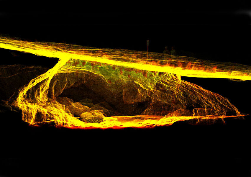
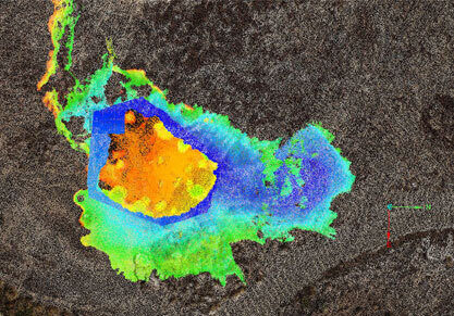
The Robe coastline has been increasingly subject to erosion hazards, and recently a large sinkhole - the size of half a tennis court - appeared suddenly at the location of the Blowhole in an area frequented by the public. In addition, the iconic Cape Dombey Obelisk, which was constructed in 1855 on top of the limestone cliffs, is slowly being claimed by the sea and can only be viewed from a distance.
The Challenge
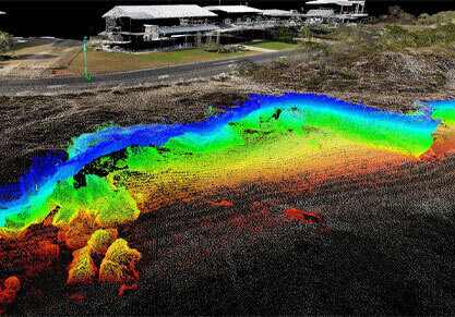
As part of an evidence-based approach to make long term decisions that positively impact the community, the District Council of Robe has been engaging with a number of different stakeholders to conduct a wider research program around coastline management. Veris were engaged as part of the program to perform LiDAR mapping of approximately 48 hectares of coastline. The project aimed to develop an accurate spatial model to provide new insights and a foundational dataset for the Council to monitor change over time and better manage the risks associated with erosion, sea level rise, and the interaction with both public and private assets.
Our Solution
Our solution showcased how the latest technologies in UAV (unmanned aerial vehicles), autonomous and mobile LiDAR mapping can be combined to safely and remotely map the natural environment.
Safety, access and data quality were key considerations that impacted our solution, given the size of the area to be covered by mapping, the instability of the limestone cliffs, the prevalence of a sink hole and proximity to the water.
UAV LiDAR survey
A large-scale UAV LiDAR survey was used to map approximately 48 hectares of coastline and form the baseline model to hang the other datasets off.
Autonomous Hovermap technology
To accurately map the sinkhole, a UAV using autonomous Hovermap technology was deployed. This overcame many of the constraints, as the drone was able to fly autonomously with collision avoidance, providing a safe method to access the sink hole and capture high quality 3D data.
Handheld LiDAR technology
We also deployed Handheld LiDAR technology to map the limestone cliffs in boats, which provided a safe alternative to scan areas inaccessible by foot. In conducting the works from a boat, the weather was a key consideration and a suitable window in terms of low wind and calm seas needed to be planned for.
Web-based 3D visualisation through 3SiDe
Veris has also provided web-based 3D visualisation of the coast using its 3SiDe web platform. Available to view through any web browser, this has enabled coastal managers within the Council to easily view, analyse and engage with the data to inform mitigation strategies.
Outcomes
This project showcased how the latest technologies in UAV, autonomous and mobile LiDAR mapping can be combined to safely and remotely map the natural environment for the benefit of the community in even the most inaccessible and extreme cases.
By using a unique mix of emerging technologies such as an autonomous LiDAR, handheld and backpack mounted LiDAR, in combination with large scale aerial surveys performed by UAV, a highly detailed, 3D view of the natural environment and surrounds was achieved.
The Council recognised how this unique mix of technologies provided a complete picture of the coast which would have been unmappable in places without the Hovermap autonomous solution.
The resulting spatial model provides a baseline data set that is being used by local government and other key stakeholders to monitor change overtime and make informed decisions that ultimately protect the coastline for the community and future generations, in addition to identifying key risks to the public.