
RoadSiDe Route Assessment
A $5 billion project was launched to connect a region to the National Electricity Market, involving the construction of 840 km of transmission lines. The survey covered over 1,000 km of road, with tight deadlines and complex data processing requirements.
The Challenge
The project faced several significant challenges, primarily driven by the scale of the task and tight deadlines. The survey covered over 1,000 kilometres of road, making it the largest Mobile Laser Scanning (MLS) RoadSiDe survey to date. The extensive data collection and processing requirements tested the limits of the automated data ingestion and analytics systems. Additionally, the rapid turnaround was critical to allow truck route planning to begin promptly.
A key technical challenge was identifying the width of the roads in sufficient detail to ensure two concrete trucks could pass each other safely at any point along the route. The data collected was essential for identifying bottlenecks, enabling the client to plan roadworks for widening where necessary.
One of the main client concerns was ensuring safe access to the road corridor for surveying without requiring traffic management, prioritising safety at all times.
Customisation of the solution was also needed to meet the specific technical needs of the project, with new algorithms needing to be developed to support the fast-paced delivery.
Balancing the technical demands with the need for a cost-effective solution, all within the tight timeframe of under six months, added to the complexity of the project.
Our Solution
Veris worked closely with the Client to deliver a comprehensive, data-driven solution using automated analytics.
Mobile Laser Scanning (MLS) Deployment
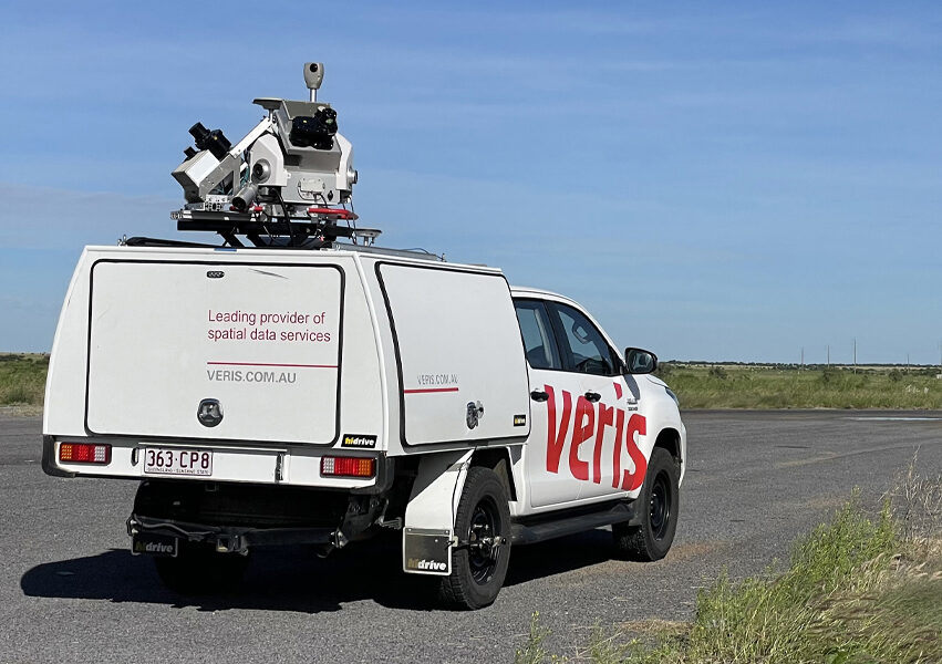
Veris deployed mobile laser scanning (MLS) technology to safely capture detailed data along both sealed and unsealed roads using LiDAR and high-resolution imagery. This process generated an asset-grade visual record.
Dilapidation Analysis and Reporting
Dilapidation reports including cracking and rutting were generated for each local government area (LGA) along the project route. These reports, with chainages corresponding to each LGA, included a comprehensive GIS dataset. This approach facilitated early positive engagement between the project team and the local councils.
RoadSiDe Platform
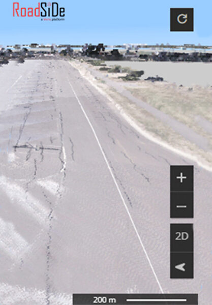
All data collected was uploaded to Veris’ cloud-based platform, RoadSiDe. This dashboard, accessible via any web browser, allowed stakeholders to visualise road conditions in both 2D and 3D. Tools within the platform enabled analysis of road width, surface conditions, and a Pavement Condition Index (PCI), giving clear understanding of overall road quality.
Routing Analysis
An automated algorithm performed routing analysis by identifying road widths at two-metre intervals along the route. Roads were categorised based on their suitability for truck routing, with the highly accurate MLS data providing a solid foundation for these calculations.
Intersection extraction for design
Veris extracted detailed features from the MLS data for 44 intersections, including centre lines, fence lines, power lines, road furniture, and changing grades. These features were sent to engineers for intersection design and upgrades, and drafted into terrain models and PDF plans to support the next phase of the project
Outcomes
The use of advanced technology to assess road widths and conditions placed the Client at the forefront of detailed planning and risk management, providing a comprehensive baseline survey of the road network during project establishment.
Key benefits include:
- Safety: Positive feedback from the construction manager for keeping personnel off the road corridor, enhancing safety.
- Rapid Data Capture and Delivery: 1,000 km of road data captured in under two weeks, with staged delivery via the platform in the following weeks.
- Improved Route Planning: Enabled the client to identify areas of concern that were previously unknown.
Detailed Baseline: Remote access to a detailed view of the entire site at project inception, improving risk management. - Remote Access and Customisation: The ability to remotely review the road corridor from Brisbane allowed daily use for planning, with dashboard customisation based on project needs.
This innovative, technology-driven approach empowered the Client to make informed decisions and effectively manage the road network and project risks.